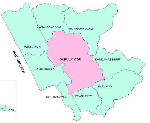
Guruvayur municipality, a town among the 8 urban local bodies in Thrissur district, acquired municipal status in the year 1994. The town is situated on the western side of Thrissur district. Guruvayur lies between 10° 55’ to 10°64’ North latitude and 76° 01’ to 76° 08’ East Longitude. Guruvayur is located 28 km from Thrissur, the district headquarters. The Guruvayur municipal area is bounded on the East by Kandanassery Gramapanchayath and Kunnamkulam Municipality; on the South by Elavally and Pavaratty Gramapanchayaths; on the West by Chavakkad Municipality, Orumanayur and Punnayoor Gramapanchayaths and on the North by Vadakkekkad Gramapanchayath and Kunnamkulam Municipality. Guruvayur (also written as Guruvayoor or Gurupavanapuri) is one of the most sacred and important pilgrim towns in India. It houses the famous Guruvayur Sree Krishna Temple, the fourth biggest temple in India in terms of the number of devotees per day. Tradition has it that the temple was created by the Guru - the Preceptor of the Devas and Vayu, the Lord of the Winds.
Guruvayur was a region on the eastern border of Malabar before the formation of Kerala. Guruvayur was under the rule of the Zamorin. During the Guruvayur campaign, Tipu had reached the Perumthattu temple near Guruvayur. Elder Hydrose ruled here as the representative of Tipu and the Zamorin. It is believed that Guruvayur was the place where the Guru and Vayu consecrated the temple. The Guru is the Devaguru Brihaspati.
Panchayat Formation/Early Administrative Committees
On January 26, 1992, Guruvayur Township was formed by including the areas of Iringapram, Chavakkad, Thykkad and Guruvayur. Guruvayur Municipality came into existence in 1994.